Healthcare access & spatial optimization
Where could ten new clinics improve access to primary care?
- Geospatial analysis
- Optimization
- Public health
- Python
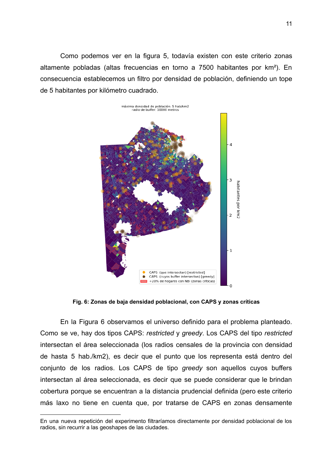
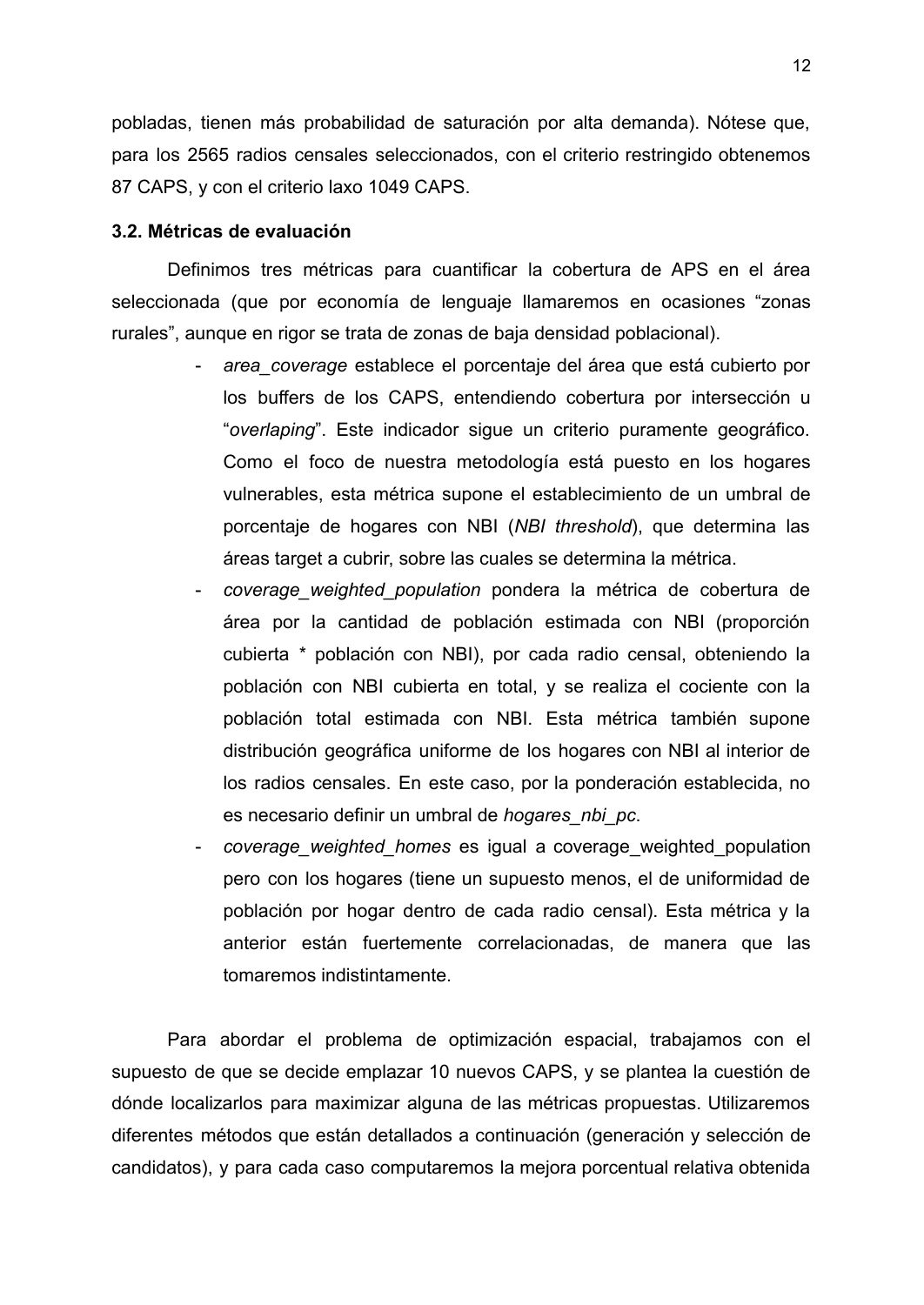
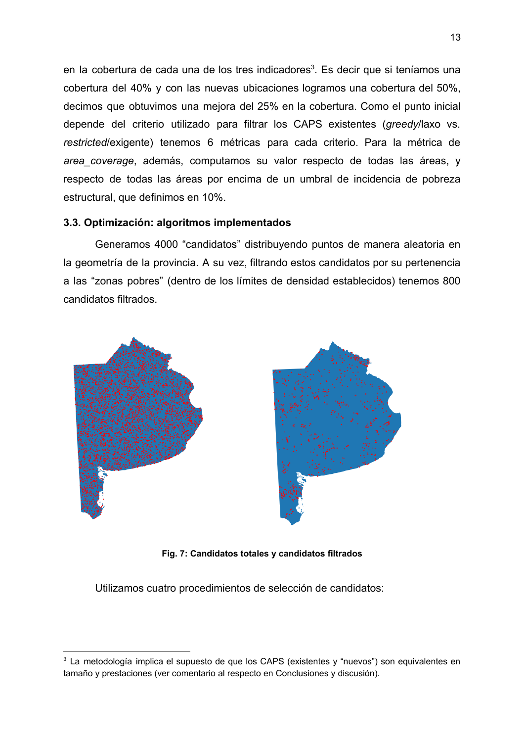
Access to primary care depends on where people live and where services are available. In rural and semi-rural Buenos Aires Province, I studied how coverage changes when geographic distance is considered alongside socioeconomic vulnerability.
The project combines an assessment of existing coverage with a simulation: if ten new primary-care centres could be added, where should they go?
Defining what coverage means
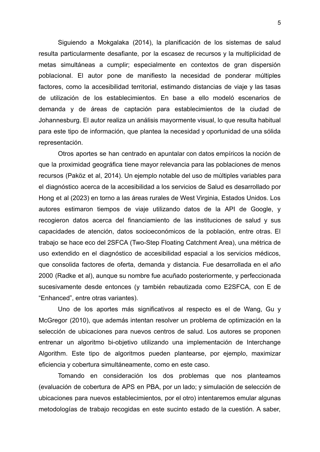
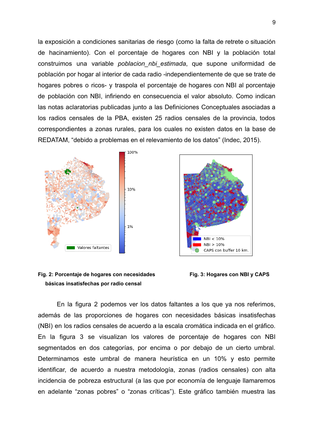
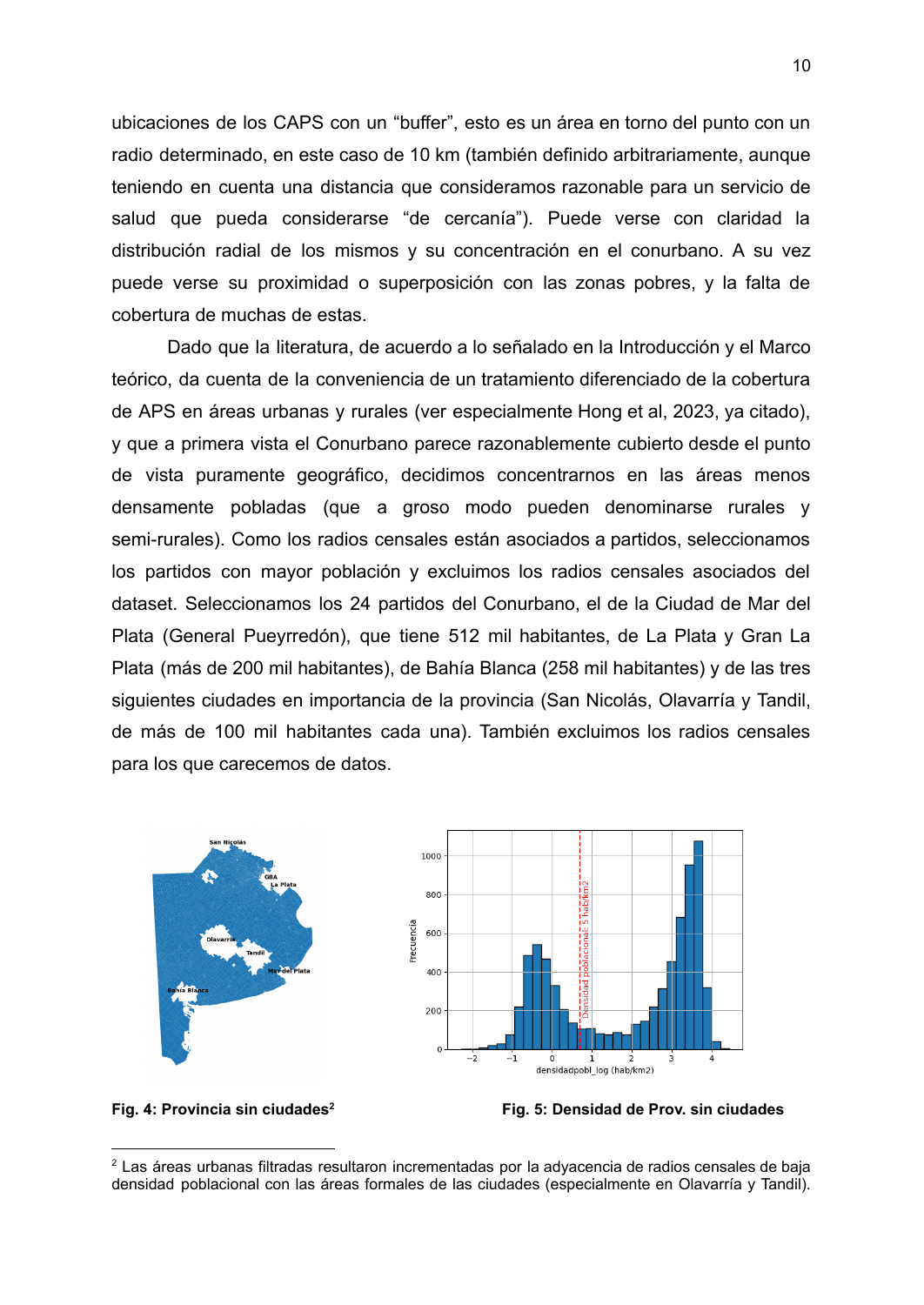
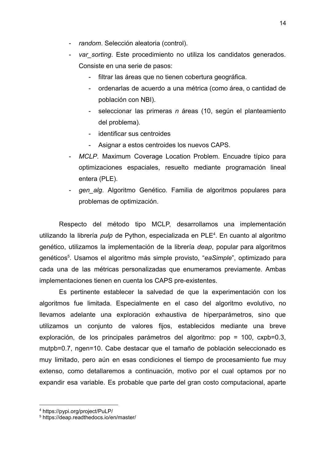
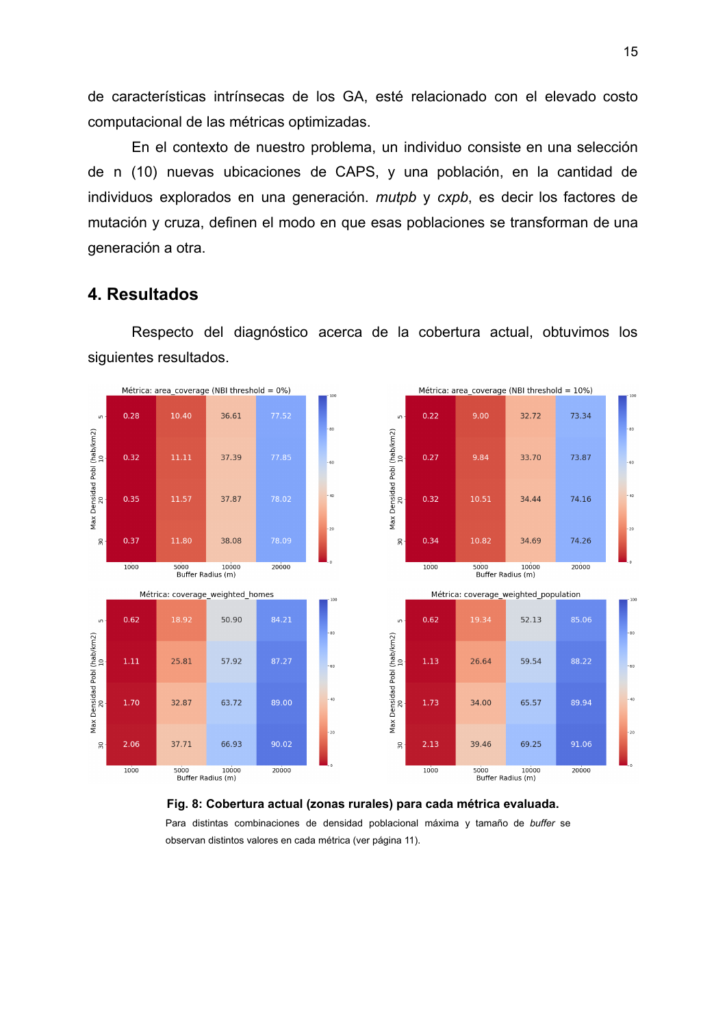
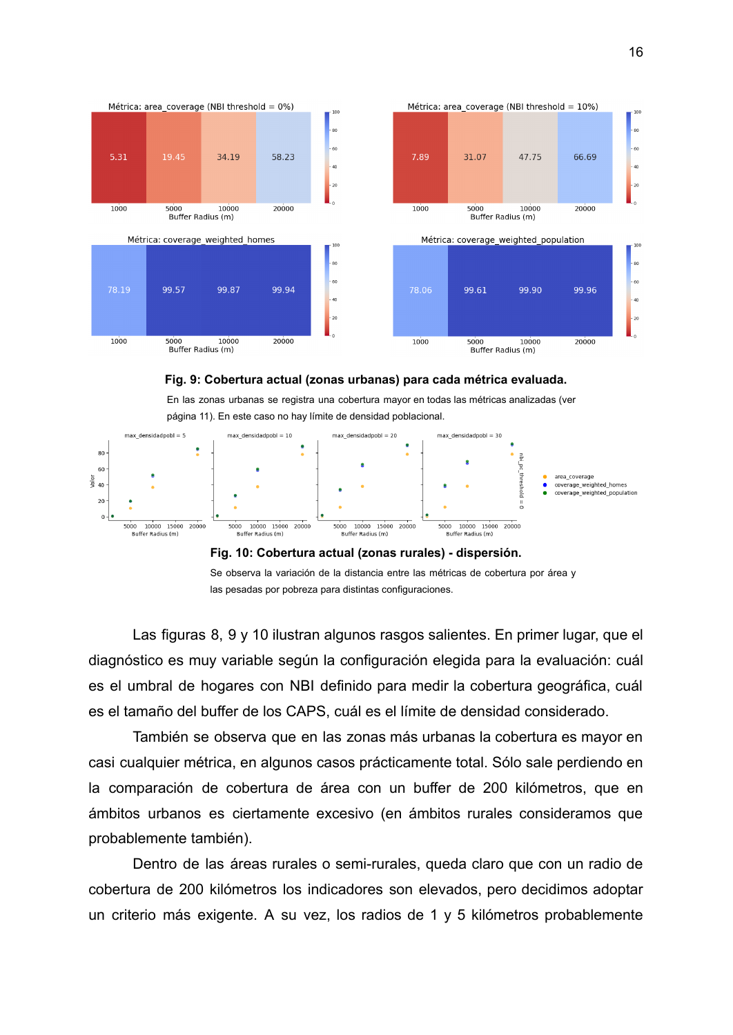
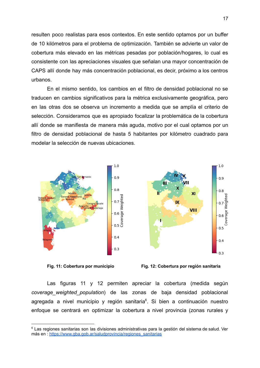
I combined public health-facility locations, census boundaries and census data on unmet basic needs. Three coverage measures distinguish the share of territory reached from coverage weighted by vulnerable households or estimated population.
That choice matters: covering a large area and reaching more people with unmet needs can favour different locations.
Comparing ways to place ten new centres
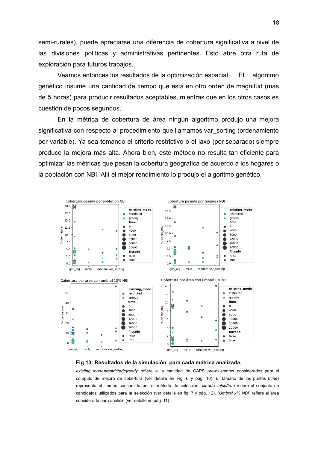
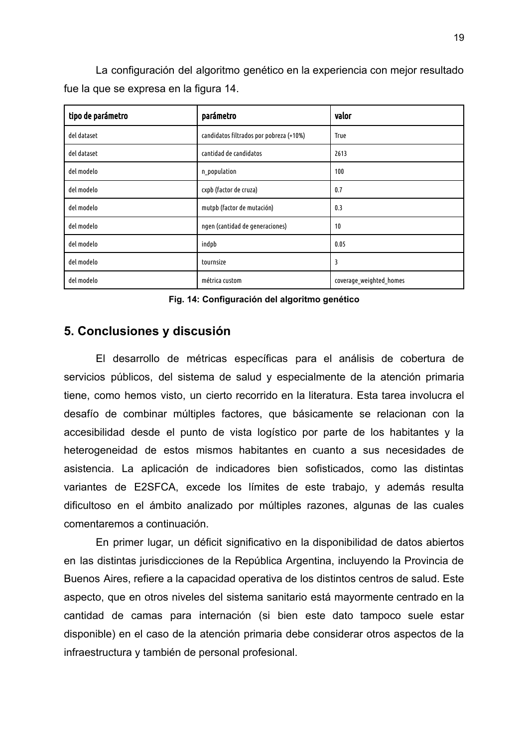
I compared random selection, a ranking heuristic, integer programming for a maximum-coverage formulation, and a genetic algorithm that could optimize the custom coverage measures. The implementations used Python, PuLP and DEAP.
In the experiments, the simple ranking method performed best for area coverage. The genetic algorithm produced better results for the vulnerability-weighted measures, but required hours of computation rather than seconds.
The comparison was exploratory, with limited parameter tuning. Coverage used geographic buffers and assumptions about population distribution; it did not model travel routes, staffing or facility capacity. The simulated locations support methodological exploration rather than an operational siting recommendation.
Full study
The original Spanish report includes the data preparation, maps, coverage definitions, experiments and limitations.